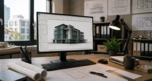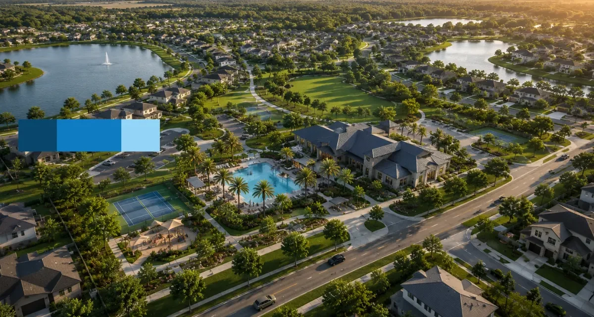
When you are developing a master-planned community, you are not just building houses or commercial spaces you are building a vision of the future. For real estate developers, urban planners, and architects, the biggest challenge is often getting other people to see that vision before the ground is even broken. This is where McLine Studios comes in. We specialize in taking massive, multi-acre project plans and turning them into highly detailed, clear aerial visuals. By translating complex site plans, topography maps, and engineering data into realistic, easy-to-understand images, we give our clients the exact visual tools they need to win over investors, secure city approvals, and launch pre-sale marketing campaigns with total confidence.
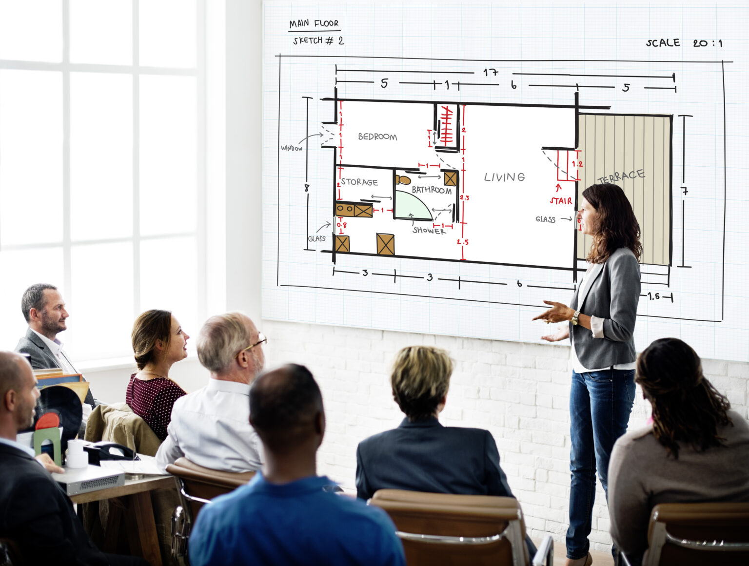
Let’s be honest: master-planned communities have a massive number of moving parts. You are trying to balance residential zones, busy commercial areas, road networks, green spaces, and utility systems all at once. Trying to explain how all of these elements connect using flat, black-and-white 2D blueprints almost never works. It leaves stakeholders guessing about the actual scale, flow, and feel of the neighborhood.
Architectural aerial rendering completely changes the conversation by providing a clear, bird’s-eye perspective. This vantage point lets anyone instantly understand how the neighborhoods connect, how traffic will flow, and how massive the project really is. At McLine Studios, we combine your exact technical data with high-end digital artistry to build visuals that are both mathematically accurate and incredibly striking.
We treat every single project with individual care. We know that you aren’t just selling bricks and mortar; you are selling a lifestyle, a community, and a long-term investment. Our dedicated approach ensures that your exact design comes across clearly, professionally, and realistically to anyone who looks at it.
Comprehensive Aerial 3D Rendering Solutions
At the absolute core of our service is a straightforward goal: we take massive, complex pieces of land data and turn them into highly accurate 3D environments. Our Aerial 3D Rendering solutions are built specifically to handle the heavy data loads that come with master-planned communities. When you are dealing with hundreds of acres, the volume of geographic and architectural detail can get overwhelming fast. We take those flat, confusing technical files and transform them into vibrant, three-dimensional perspectives that actually tell a story.
When our team sits down to work on an aerial rendering, we don’t just look at the building rooftops. A master-planned community only succeeds if its surrounding environment makes sense. Because of this, our rendering process covers every single physical detail of your site. We model the actual topography of the land, making sure that hills, slopes, valleys, and water features perfectly match real-world conditions. From there, we build out the infrastructure layer mapping out main roads, highway exits, roundabouts, walking paths, and utility spaces exactly as your engineers planned them.
Landscaping is another massive factor in making a community feel like a place where people actually want to live. Our team carefully places digital trees, shrubs, lawns, and parks to align perfectly with your project’s landscape architecture plans. This creates a balanced, natural look that makes the entire development feel authentic and alive. By providing these premium architectural visualization services, we help you present a unified, polished look for your project. Whether you need to show a family how close their future home is to the local school or show a retail tenant how accessible their storefront will be from the main highway, our aerial views give you the perfect angle to explain it all clearly.
Precision-Driven CAD Rendering Services and Technical Visualization
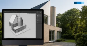
A beautiful aerial visual is completely useless if it isn’t accurate. Master-planned communities rely on highly detailed files from engineers and architects, and these files require skilled, professional handling. Our CAD Rendering Services are rooted in a deep, practical understanding of architectural drafting, civil design, and geographic data. We don’t guess when it comes to property lines, building heights, or lot sizes we build our 3D scenes directly from your official project files.
Moving from flat 2D CAD layouts to a complete, realistic 3D world requires a highly systematic approach. It involves sorting through massive amounts of data, cleaning up messy line work, and setting up a perfectly scaled digital base layer. Our drafting teams carefully extrude building footprints, align roads to the terrain data, and make sure that setbacks and local zoning boundaries are strictly followed inside the digital space. This extreme attention to detail is what separates professional 3D CAD rendering from basic graphic illustrations. It gives you a reliable, faithful representation of your approved plans that you can confidently bring into strict zoning board meetings, city council presentations, and planning commissions.
To keep these massive files running smoothly without losing detail or missing deadlines, McLine Studios uses a structured internal workflow that ensures high quality at every step:

Phase 1: Technical Ingestion: We import, clean up, and align your foundational CAD and GIS data, making sure our digital ground matches the real-world site perfectly.
Phase 2: Scalable Asset Management: We populate the massive area with 3D models of homes, commercial spaces, and infrastructure, using smart file optimization so the project stays organized and responsive.
Phase 3: Environmental Texturing: We bring life to the bare digital structures by adding realistic materials, natural lighting setups, and accurate vegetation that matches your landscaping plans.
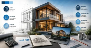
Phase 4: High-Fidelity Rendering: We use high-performance computing power to calculate realistic light, shadows, and reflections, delivering crisp, multi-angle views of your unbuilt community.
Diverse Applications of Commercial 3D Rendering
Large-scale land developments come in all shapes and sizes, and our team is built to adapt to all of them. While master-planned residential neighborhoods make up a major part of what we do, our Commercial 3D Rendering services cover a massive range of regional, commercial, and mixed-use projects. Every single site has its own unique goals, features, and target audiences, and we tailor our visual approach to fit exactly what you need to sell.
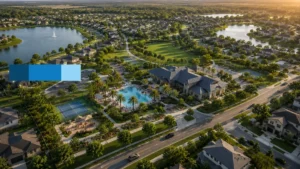
- Sprawling Residential Subdivisions: For these projects, the focus is usually on the neighborhood layout, lot availability, and shared amenities. Our aerial views highlight the flow of cul-de-sacs, the safety of the street layouts, the placement of parks or community clubhouses, and the clear connection between different build phases. This helps future homebuyers zoom in and find exactly where their family’s home will sit.
- Mixed-Use Urban Districts: Modern master plans frequently blend high-density housing with retail shops, offices, and dining areas. These renderings require a very careful touch to show how different zones interact. We highlight pedestrian-friendly walkways, public transit connections, parking structures, and the active, bustling day-and-night atmosphere of the commercial spaces.
- Resort and Lifestyle Communities: Projects built around golf courses, lakes, marinas, or natural parks need a heavy emphasis on the environment. Our visualization techniques capture the depth of water features, fairway layouts, and the way luxury properties sit naturally within the landscape, protecting and projecting the premium feel that drives high-end real estate sales.
- Industrial and Logistics Parks: Massive business parks and shipping hubs rely purely on operational efficiency. For these projects, our architectural aerial rendering focuses on highly practical needs: semi-truck turning radiuses, loading dock layouts, large-scale employee parking, and direct highway access points that major corporate tenants look for before signing a lease.
Ensuring Unmatched Accuracy and Scalability in Aerial View Rendering
When a project spans hundreds or even thousands of acres, keeping track of both the big picture and the tiny details is a major technical challenge. At McLine Studios, we have spent years refining our workflows to make sure our aerial view rendering stays completely accurate, sharp, and true to life, no matter how large your property line stretches.
Realism always starts with the ground itself. We use advanced terrain modeling to make sure the site’s grading is entirely correct. If your project includes terraced homes built into a steep hillside, our renderings will show the exact slopes, retaining walls, and true elevations. This absolute commitment to the actual geography of the land means you never have to worry about showing an unrealistic, idealized version of the site to buyers, city boards, or investors. What we render is what can actually be built.
We also pay incredibly close attention to lighting, weather, and atmosphere. An aerial view changes completely depending on the time of day. We work directly with you to pick the right lighting for your specific business goals. For example, a warm “golden hour” sunset rendering is absolutely perfect for building an emotional connection with potential buyers for a residential neighborhood. On the flip side, a bright, clear midday sun might be much better for showcasing the clean architecture, glass reflections, and efficiency of a corporate campus. Our artists calculate realistic shadows from every single building and tree, giving the final image a true sense of depth and realism.
Designs change, plans get rezoned, and layouts get tweaked that is just the natural reality of large-scale land development. Because we build our 3D scenes using highly organized, modular 3D CAD rendering practices, we can update specific phases or sections of a master plan quickly without having to rebuild your entire project from scratch. This flexibility saves you time, cuts down on revision costs, and keeps your marketing assets perfectly accurate as your architectural plans evolve.
Elevate Your Presentations with Premier Architectural Visualization Services
Bringing a new master-planned community to market successfully means showing it off with absolute clarity. Relying on hard-to-read 2D maps, confusing blueprints, or low-quality graphics can slow down city approvals, cause investor hesitation, and stall your pre-sales. McLine Studios effectively connects the dots between technical engineering plans and highly effective marketing imagery.
With our specialized Aerial 3D Rendering, you can walk into any presentation, board meeting, city hall hearing, or sales center with total confidence. Our team focuses heavily on technical accuracy and clean, premium design, making sure every road, building, and green space looks exactly right. We handle everything from the initial file transfer to the final delivery of crisp, high-resolution imagery. Partner with McLine Studios for your next major development, and let our architectural visualization services turn your master plan into a clear, undeniable reality that people can see, understand, and trust.