Aerial 3D Rendering Services
Aerial 3D Rendering
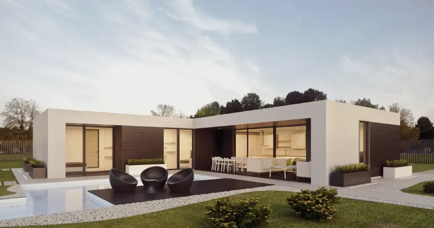
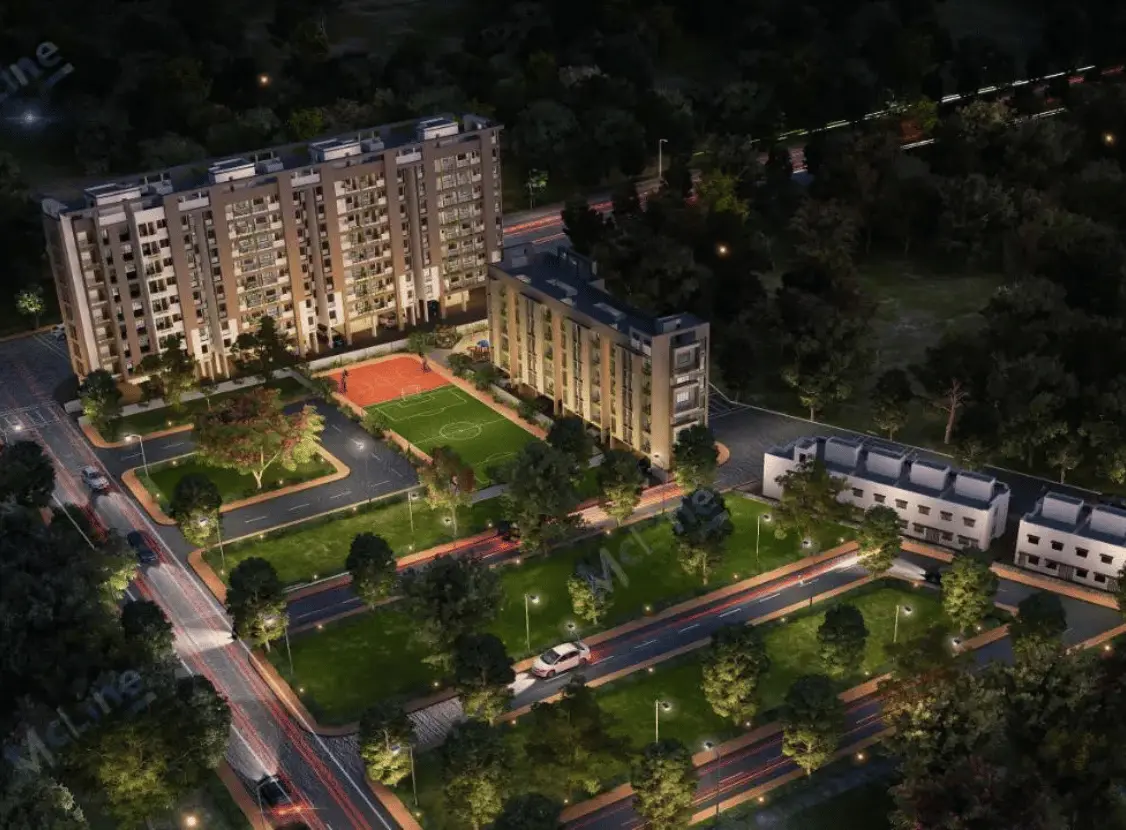
We specializes in offering cutting-edge aerial 3D rendering services, providing clients with immersive perspectives through aerial view renders and aerial vision renders. Leveraging advanced technology and expertise, McLine Studios captures the essence of architectural projects from unique aerial angles, allowing stakeholders to visualize designs with unparalleled clarity and detail.
Whether it’s for real estate development, urban planning, or architectural presentations, our aerial 3D rendering services enhance project visualization to new heights. With precise attention to detail and a keen eye for capturing the essence of spatial design, We delivers renderings that not only showcase the physical attributes of a project but also evoke emotion and imagination.
For architects and urban planners, aerial 3D rendering provides valuable data for site analysis, allowing them to make informed decisions during the design phase. Real estate developers leverage these renderings to showcase properties from unique perspectives, attracting potential buyers and investors.
Additionally, construction companies utilize aerial 3D renderings to monitor progress, identify potential issues, and streamline project management. The level of detail and accuracy achieved through 3D rendering services is remarkable, allowing stakeholders to visualize projects with exceptional clarity and realism.
Our Aerial 3D Rendering SERVICES
Photorealistic Aerial Rendering
Professional photorealistic aerial rendering services: realistic, detailed visuals for architectural, environmental, and urban planning projects.
Terrain Aerial Rendering
Terrain aerial rendering services create accurate 3D models from aerial imagery for various applications.
Orthographic Aerial Rendering
Providing detailed bird’s-eye views for architectural and urban planning purposes.
Perspective Aerial Rendering
Detailed bird’s-eye view illustrations enhancing architectural projects with precision and realism.
WorK Samples
TESTIMONIALS
OUR PROCESS
Getting to know you
In the kick-off meeting, we analyze CTB files, architectural drawings, scope of work, color schemes, materials,
site location, camera angles, hardware schedules, and AutoCAD templates to understand the project in detail.
Getting to work
Following the call and internal resource allocation, our rendering specialists delve into their tasks. They import the plans and commence the creation of your 3D visuals.
Getting ready for review
After completing the initial draft, it
undergoes an internal quality check before being submitted for your review.
Getting feedback and final approvals
After you provide your feedback, our
experts will revise the drawings
accordingly and re-submit them for final approval.
Aerial 3d rendering Services - Frequently Asked Questions
What is aerial 3D rendering, and how does it differ from traditional rendering?
Aerial 3D rendering involves creating highly detailed, three-dimensional models of landscapes, properties, or structures from an aerial perspective. This perspective provides a holistic view of the environment and helps in accurate visualization. Unlike traditional rendering, which often focuses on ground-level views, aerial rendering offers a broader perspective, useful for urban planning, real estate development, and landscape design.
What industries can benefit from McLine Studios' aerial 3D rendering services?
Our services cater to a wide range of industries, including real estate, urban planning, architecture, construction, landscaping, environmental conservation, and tourism. Essentially, any sector that requires accurate visualizations of large-scale areas or structures can benefit from our aerial 3D rendering services.
What types of projects can McLine Studios undertake with aerial 3D rendering?
We can handle various projects, including but not limited to urban development planning, architectural visualization, site analysis, land surveying, infrastructure design, property marketing, and virtual tours. Whether it’s a residential development, commercial complex, or natural landscape, our team can create stunning aerial renderings tailored to your specific needs.
How accurate are the aerial 3D renderings produced by McLine Studios?
We utilize cutting-edge technology, including drones and advanced software, to capture high-resolution aerial imagery. Our skilled team meticulously processes this data to create detailed and true-to-life 3D models. We strive to deliver renderings that accurately represent the physical environment or structure, allowing clients to make informed decisions confidently.
Can McLine Studios incorporate specific details or features into the aerial 3D renderings?
Absolutely. We understand that each project is unique, and our goal is to tailor our services to meet your specific requirements. Whether you need to highlight specific landmarks, infrastructure elements, landscaping features, or architectural details, we can incorporate them into the aerial renderings to provide a comprehensive visual representation.
What is the typical turnaround time for aerial 3D rendering projects at McLine Studios?
Turnaround times can vary depending on the complexity and scale of the project. We strive to deliver high-quality results efficiently. Upon discussing your project requirements, we can provide you with a detailed timeline outlining the various stages of the rendering process, from data capture to final delivery.
Are the aerial 3D rendering services offered by McLine Studios customizable to fit different budgets?
Yes, we understand that budgetary constraints may vary from project to project. We offer flexible pricing options and can tailor our services to accommodate your budget while ensuring high-quality results. During the initial consultation, we’ll work closely with you to understand your budget and project goals, providing recommendations to achieve the best possible outcome within your financial parameters.
How can I get started with McLine Studios' aerial 3D rendering services?
Getting started is easy. Simply reach out to us via phone or email to schedule a consultation. During the consultation, we’ll discuss your project requirements, objectives, and any specific details or features you’d like to incorporate into the aerial renderings. From there, we’ll provide you with a customized proposal outlining our approach, timeline, and pricing. Once agreed upon, we’ll commence work on bringing your vision to life with stunning aerial 3D renderings.
